
News in 2016
|
 |
A new version of Cadastral Template has been launched. The Cadastral Template and the improved version has been developed by a research group at the Centre for SDIs and Land administration, Department of Infrastructure Engineering of the University of Melbourne led by Professor Abbas Rajabifard, Dr. Daniel Steudler (swisstopo, Switzerland), and Professor Ian Williamson, supported by Professor Stig Enemark from Aalborg University, Denmark. |
The Cadastral Template was established under UN mandate by Resolution 4 of the 16th UNRCC-AP in Okinawa, Japan in July 2003.
Field data
The cadastral template is based on a raster of 17 data fields, which would need to be filled in according to its specific description. You can find that description in the questionnaire.
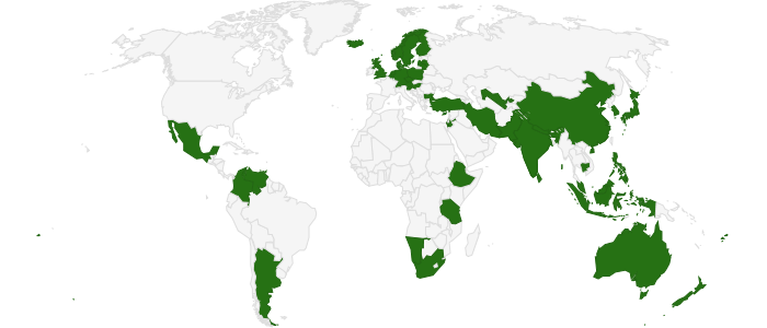
See the participating countries at: www.cadastraltemplate.org
Is your country information updated? Check the Cadastral Template Web Site
31 August 2016